I stopped in Panama on my way back from Chile, because a three-day stopover didn’t cost any more than flying straight home. After a few weeks of other miscellaneous trips to see friends and family, I’m finally getting around to sharing some highlights.
Panama City
Panama’s City’s skyline is bigger than San Francisco’s and probably most cities in the United States. The skyscrapers stretch along the edge of the the Pacific Ocean. A giant road called the Cinta Costera was built above the ocean so that cars can avoid going through the busy streets in old town. Fortunately, city planners also added a path for bicycles and pedestrians with great views of the old town and the new city. Walking along the road was a lovely relaxing break from the hustle and bustle of the city itself.
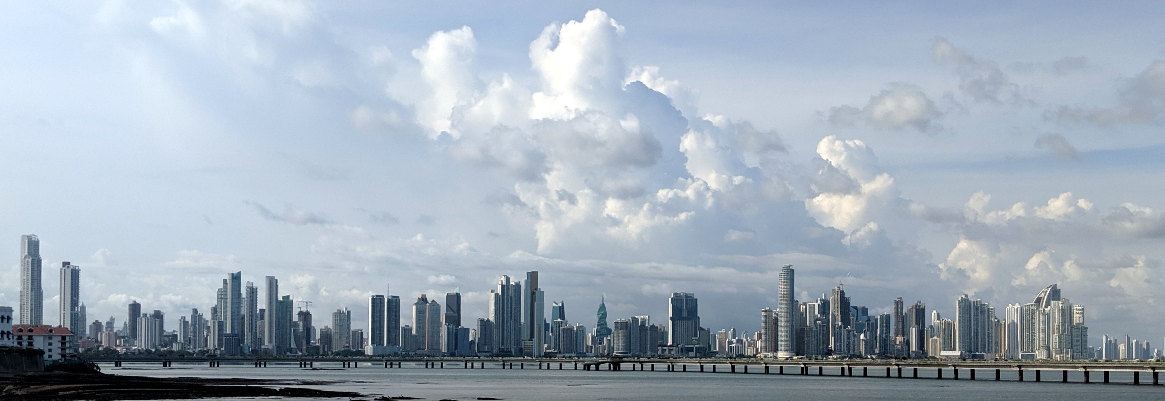
view of downtown Panama City from the Cinta Costera
I visited MAC Panama, the contemporary art museum in Panama City and saw an entire exhibit by the Venezuelan op artist Carlos Cruz-Diez. He spent most of his life exploring color and the movement of color. Due to his commercial success, he is one of Latin America’s most well-known artists, but sadly, just a couple weeks after I saw this exhibit, he passed away.

works by French-Venezuelan artist Carlos Cruz-Diez
I honestly didn’t eat much Panamanian food while I was there, but I did get some delicious fancy vegetarian food at a lovely restaurant in old town called Tio Navaja. On my last day, I stopped by a street vender to buy a passion fruit raspado, full of icy goodness.

vegan patacones, tacos, and a creamy passion fruit raspado
Agua Clara Locks
Of course, the main thing I wanted to see in Panama was the Panama Canal itself. It’s the 51 mile shortcut between the Atlantic and Pacific Oceans that most cargo ships take to shorten their journeys. Because of the topography of the land, locks are needed to move boats safely from one side of the isthmus to the other. They need to go up 3 sets of locks and down 3 sets of locks.
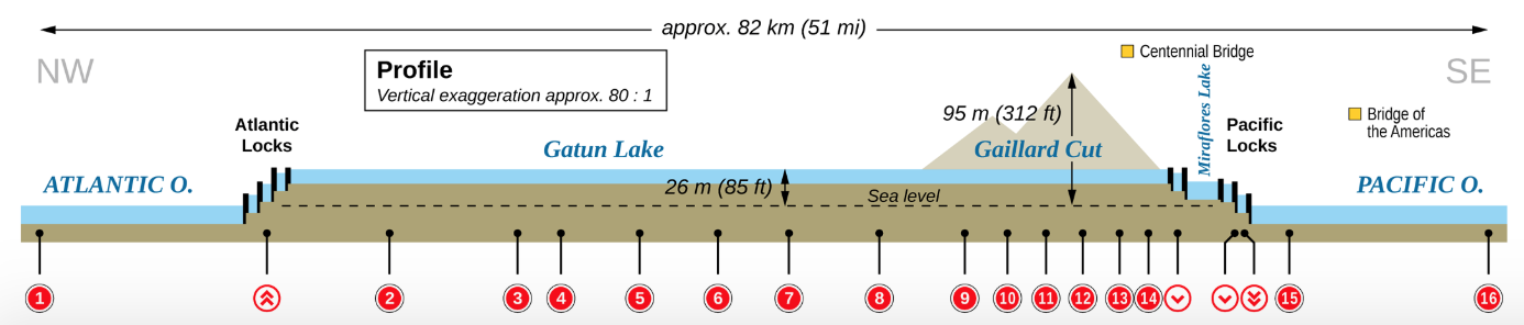
Panama Canal diagram (link to original on Wikipedia)
I visited the Agua Clara Locks which were expanded a few years ago to allow more and bigger boats to go through, while doing a better job of recycling the water needed to run the locks. Guides to the locks will say that the Panama Canal expansion is good not only for the global economy, but also for fighting greenhouse emissions. First, taking the canal route alone cuts down the amount of fuel needed to get from one ocean to the other. Instead of going around the long way, they wait around for about a week and then go through the canal once their turn arises in the queue. Second, this expansion allows bigger boats to go through (the new Panamax style) that can carry 120,000 tons of cargo, which means less boats need to be coming and going.
I’m not sure I buy their arguments, mostly I think it just means more ships and more stuff will be going through the canals. It’s like when cities build more roads to accomodate more cars, but then the roads fill up with even more cars. This is called induced demand and although I’m glad they’re doing work to make these locks more energy efficient and water efficient, my guess is that there’s still a net positive of carbon emissions after these were created.
The locks, regardless, are fascinating to watch in practice. On the big new Panamax ship in the photo below, it took six tugboats to properly align the boat with the lock, two on each side and one at the front and back. When the boat enters the canal, a Panamanian captain takes control for the duration of the canal transit. There’s just a couple feet of safety room on either side so the captain is in constant communication to all the tugboats while maneuvering the boat into the lock. Once inside the locks, the tugboat at the front and back stay with the boat until it exits. This boat in this photo was on its way out to the Atlantic Ocean and had started its journey in Hong Kong.
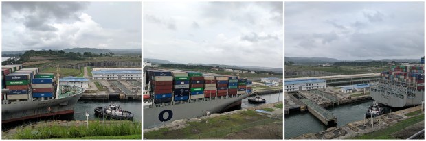
- new Panamax cargo boat transiting through Agua Clara locks with support tugboats

One of the coolest parts of being near the canal is watching the different types of boats go by. Some carry oil, some carry containers, some carry natural gas, and some carry cars! The boats that carry cars are completely enclosed so that the cars arrive in pristine condition. They are are called RORO because cargo is rolled-on, rolled-off.
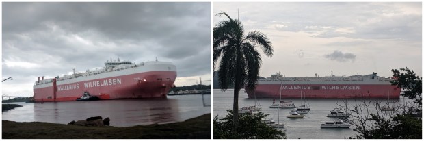
- RORO cargo boat entering the Panama Canal from the Atlantic Ocean (view from right before the old locks near Agua Clara) and leaving to the Pacific Ocean (view from my hotel)

It takes about 8-10 hours for a ship to go through the Panama Canal. I saw the boat above enter the locks on the Atlantic side in the morning around 7am and then around 4pm, I watched it head towards the Pacific from my hotel balcony in Panama City.
Boats generally arrive up to a week in advance and they wait around until they are directed to go through. Although tiny private vessels go through for a few thousand dollars, the big ships cost around half a million. Apparently, the current record is around $1.2 million for one of the new Panamax ships loaded down with cargo. One guy swam through a while back and under the old rates was charged 36 cents, which was calculated based on the carrying capacity of his stomach. 🙂
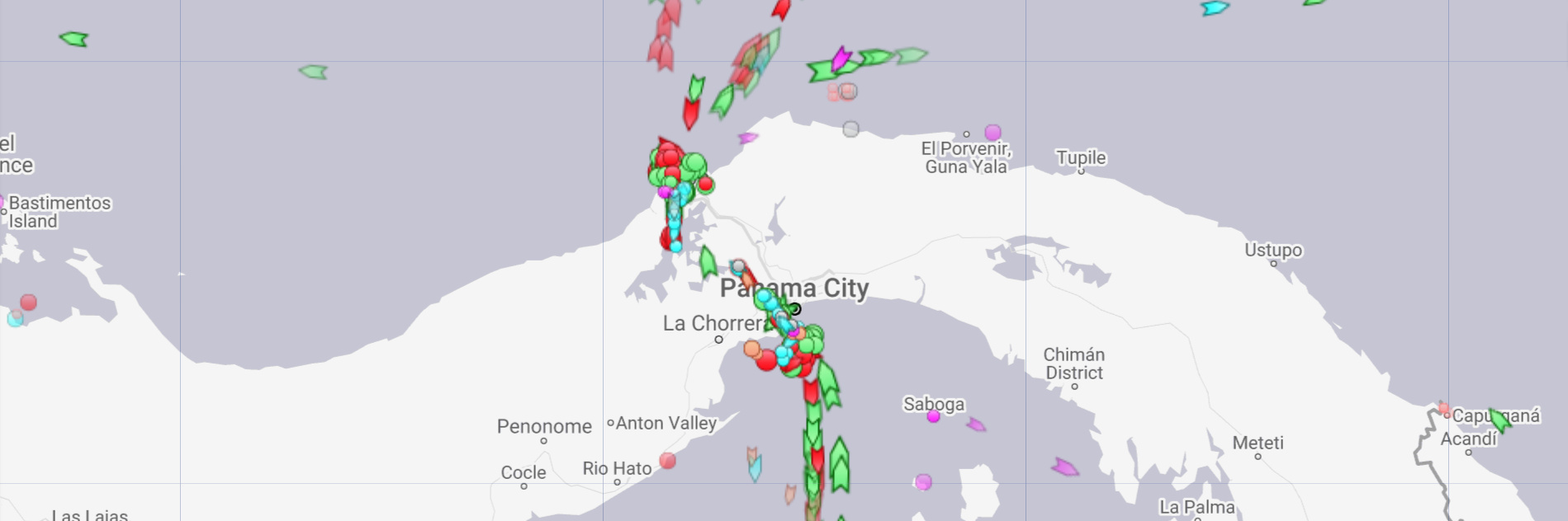
recent view of Panama Canal traffic (from www.marinetraffic.com)
Last fun fact about the Panama Canal: It was almost built through Nicaragua instead because the land topography meant less digging would be necessary.
Fort San Lorenzo
This fort is on the Atlantic side of Panama and was originally built in the 1500’s to protect the treasures arriving from the Camino de las Cruces, the earliest colonizer route across Panama. Some of you might remember reading about the silver mines in Potosí, Bolovia. All of that silver (along with gold from other parts that were being plundered in South America) was shipped up to the Pacific side of Panama and then transported along this route by people, mules, and boats to the other side. Once they arrived at this fort, the precious metals would stay there until the annual “treasure fleet” set sail back to Europe, traveling in a convoy for protection.
Eventually, the pirate/privateer Henry Morgan (yes, Captain Morgan rum is named after him), attacked the fort and left it in ruins, but it was rebuilt ten years later.

Fort San Lorenzo entrance, moat, and the view out over the Panama Canal
Monkey Island
Panama is home to amazing wildlife and rainforest. I would love to come back and see more of it. The only glimpse I got was a visit by boat in pouring rain to briefly see Monkey Island, where we got to spot some capuchin monkeys. They were cute though. 🙂
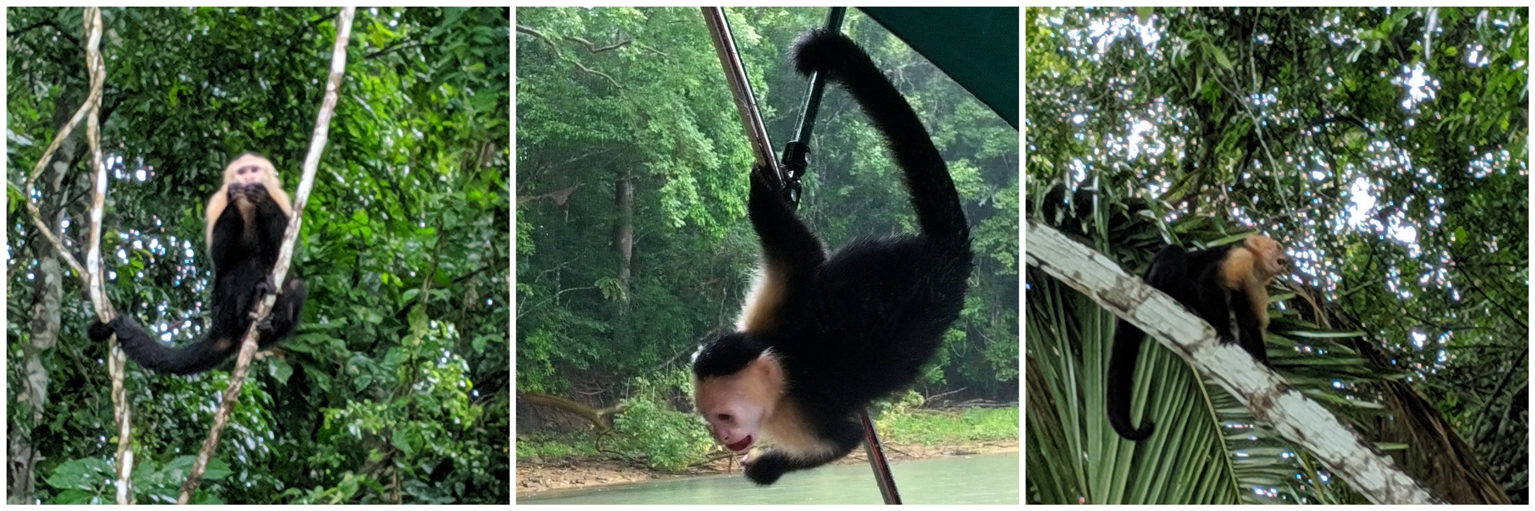
white-faced capuchin monkey

David and I definitely want to go to see the canal in Panama and is Monkey Island really close by there cuz that sounds awesome
LikeLike