Fiji Village
Although I spent most of my time in Fiji in the water, I did take the opportunity to visit a local village during my stay. Many of the people who worked at the hotel I stayed at came from this nearby village. We had a tour guide for our visit and he said that a lot has changed since the resort was built. Walking around town, there were solar panels providing electricity to many houses as well as backup water tanks. Most houses had moved their kitchens indoors out of the rain. We were able to peek inside the local church, medical offices, and school but none of these were in session.
The most interesting thing for me was the lali drum in the center of the village near the church. When it is hit, it makes a deep resonant sound that calls villagers in for meetings or to celebrate an event. Lali drums are still used today and continue to play an important role in Fijian culture and traditions.

Fijian church, lali drum, alphabet paintings on school wall
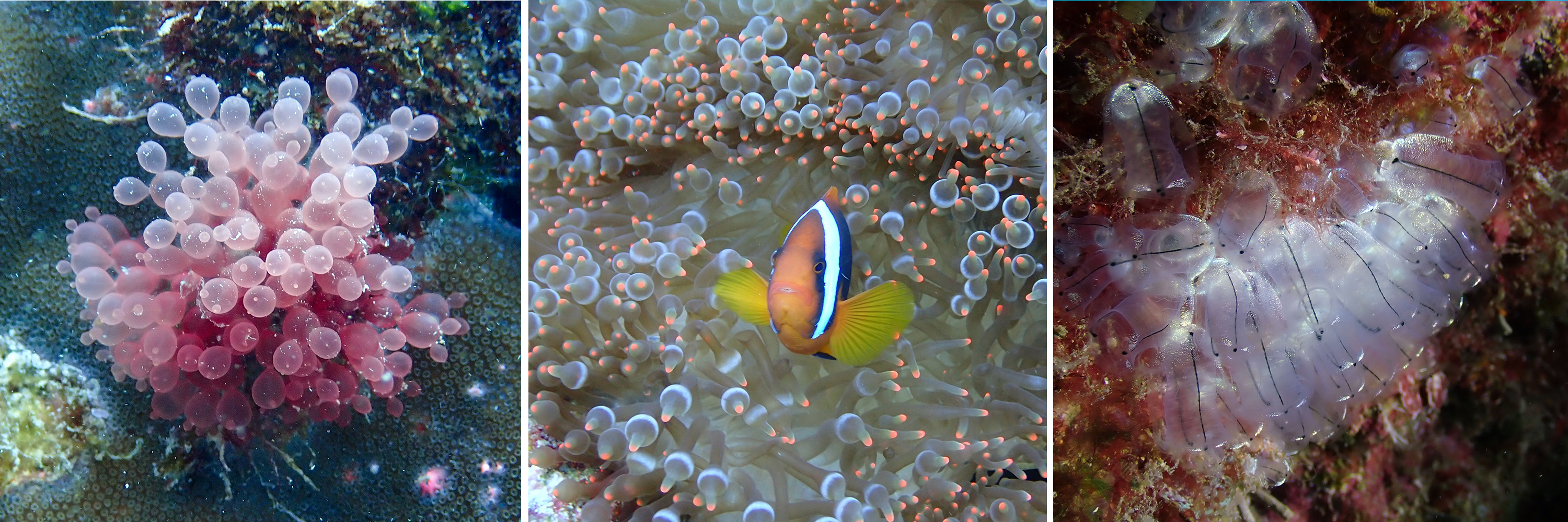
Night Snorkel
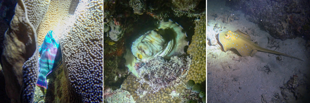
I had already done a night dive, but I figured I could squeeze in at least one more night adventure at the next place I stopped. It ended up being a good one. I saw a Partridge Tun Snail that was over a foot long and slowly making its way along the seafloor. Their main source of food is sea cucumbers which are also much more plentiful at night. There were also a couple of turtles and reef sharks ominously swimming around us. Every so often I’d catch a glimpse of a tail or a fin. Reef sharks are generally not aggressive and they feed on tiny fish and crustaceans. They seemed to be mostly curious about the group of humans in the water while keeping their distance.
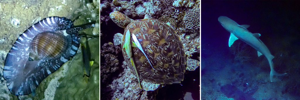
Partridge Tun Snail, Green Sea Turtle (with remoras on its back), Blacktip Reef Shark
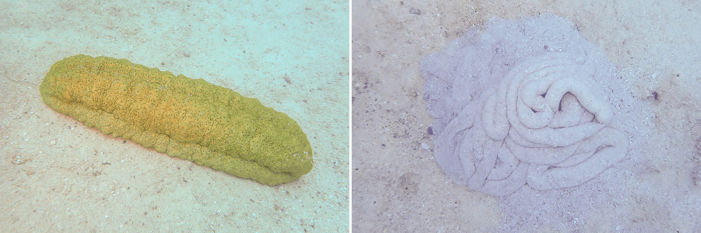
Sea cucumbers come out in force in the evening hours. I continue to delight in all the shapes, sizes, and textures that they come in. They are so strange and loveable, looking like giant blobs making their way ever so slowly across the ocean floor.
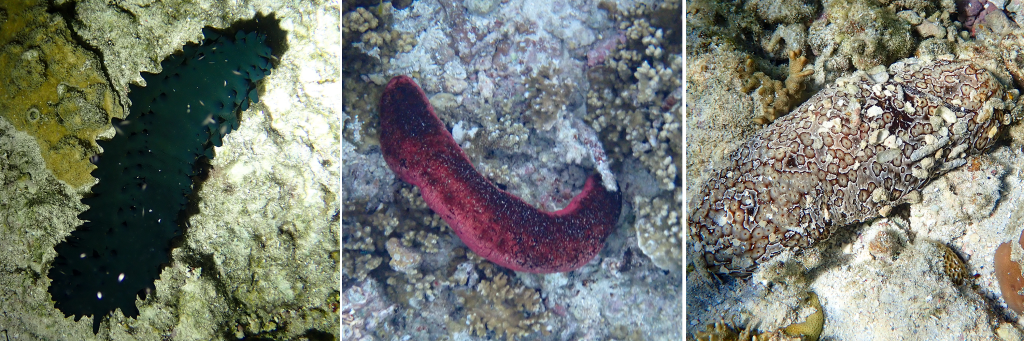
Greenfish Sea Cucumber, Pinkfish Sea Cucumber, Leopard Sea Cucumber
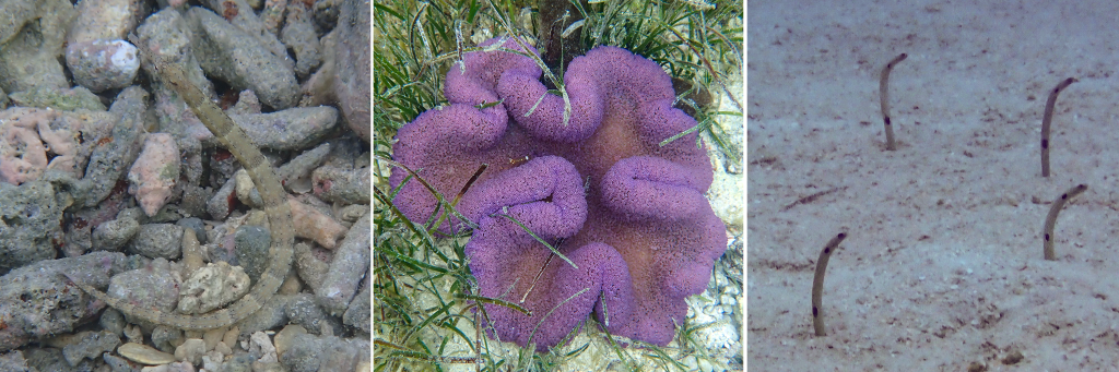
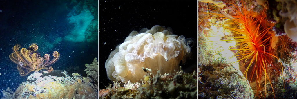
The one in the photo below is a bit smaller, but while in Fiji I saw a Graeffe’s Sea Cucumber that was over two feet long. During the same night snorkel, our guide also managed to spot another day octopus out and about after dark. I’m beginning to think this species needs a new common name, although plenty of people insist they do see them during the day as well. At first glance, the Lion’s Paw Sea Cucumber looks almost like a snake lying on the seafloor. Once it starts moving, though, it resembles a wrinkled, expandable garden hose slowly inching its way across the ocean floor.
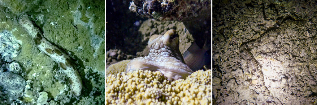
Graeffe’s Sea Cucumber, Day Octopus, Lion’s Paw Sea Cucumber
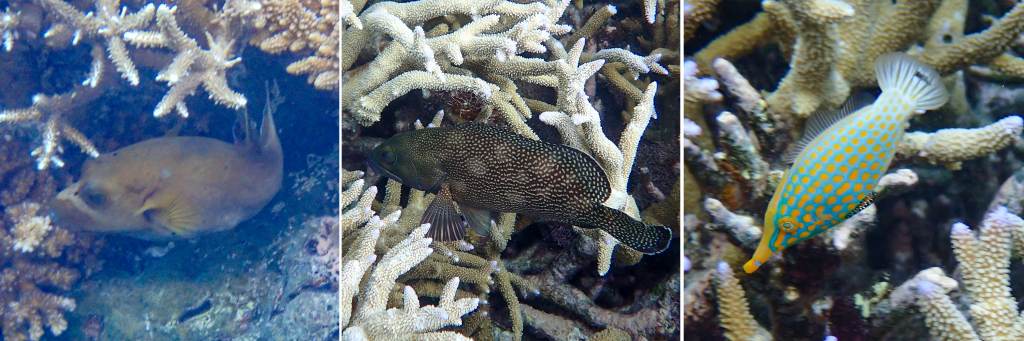
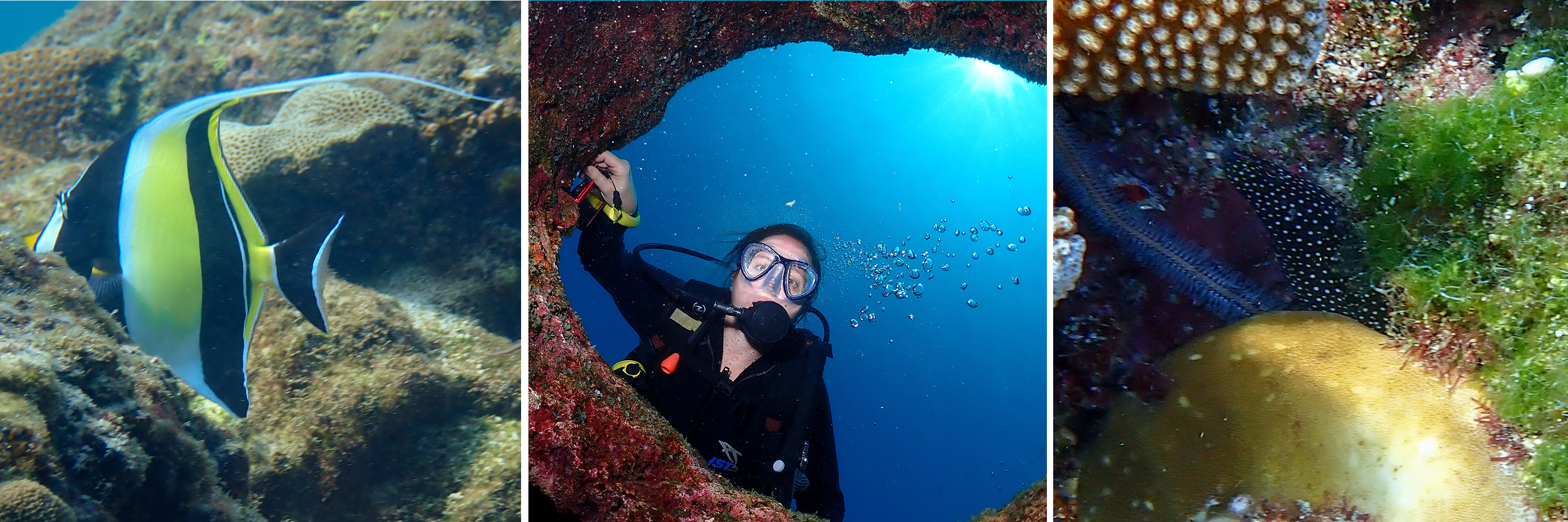
Fish
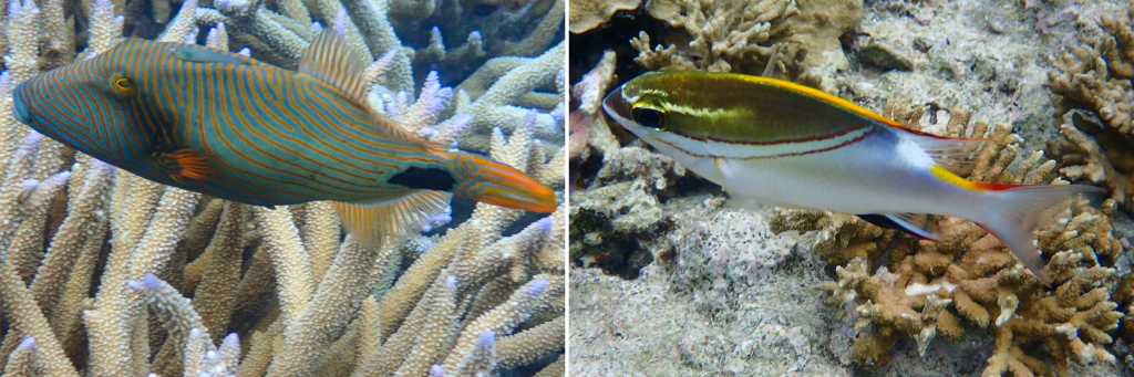
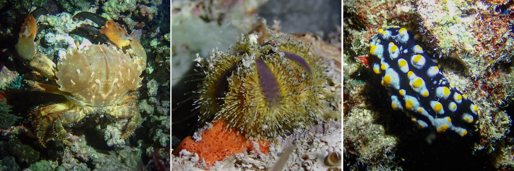
To be honest, I’m generally not that into fish. Some species, like the lagoon triggerfish (also the state fish of Hawaiʻi), are relatively easy to identify because their patterns are so unique and distinctive. When I first started snorkeling, I often felt overwhelmed trying to identify and name different species. After each trip, I would go home, download my photos, and carefully upload them to iNaturalist so I could learn their names. That approach was genuinely helpful. I began to recognize different fish shapes and groupings, even if the specific species names did not always stick.
In many ways, that is still how I think about fish. Does it fit into a group I already recognize? Or does it stand out as something distinctive? Are the patterns interesting? Does it have an unusual color pattern or a unique shape? Any of these traits might prompt me to reach for my camera and pay closer attention when identifying it later on iNaturalist.
There is no single right way to learn about sea life. It is perfectly fine to snorkel or scuba dive and simply appreciate the beauty of coral reefs without knowing any names. For me, learning some of their names adds another layer of enjoyment. Names open the door to a deeper understanding, giving me access to each species’ story, behavior, diet, and role within its ecosystem.
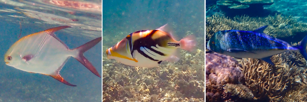
Snubnose Dart, Lagoon Triggerfish, Bluefish Trevally
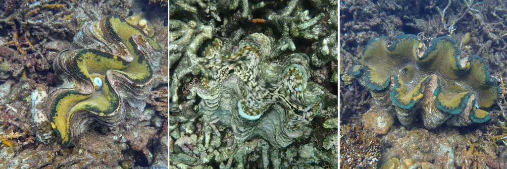
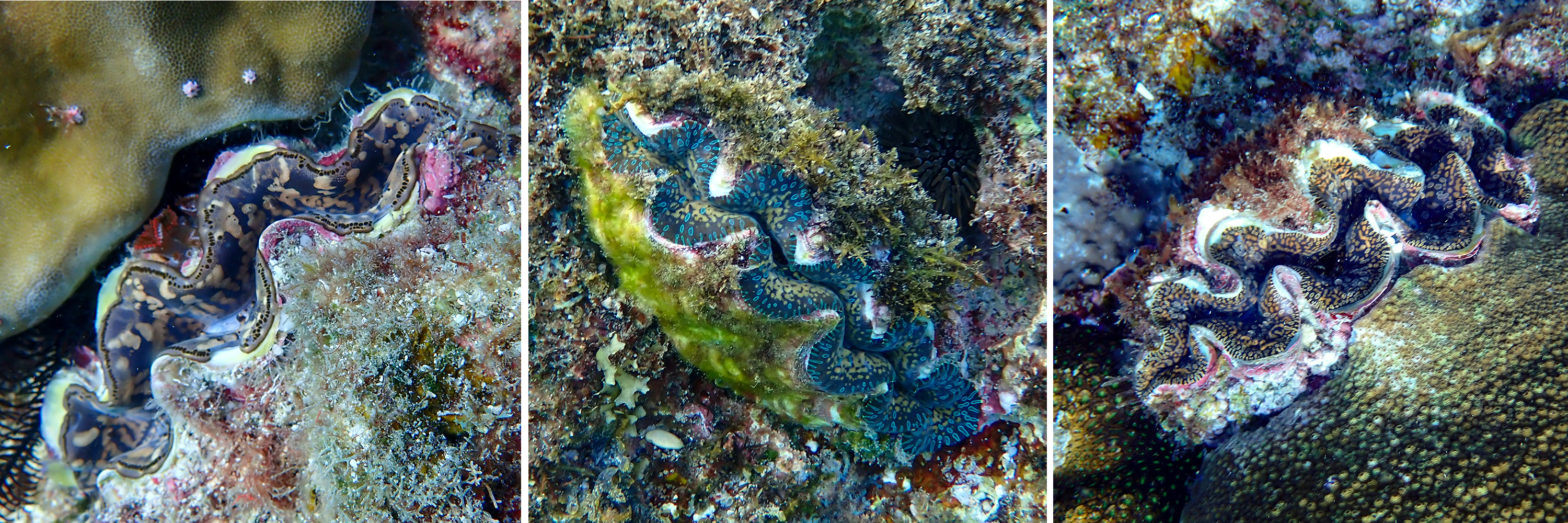
Giant Clams
These giant clams also have a symbiotic relationship with dinoflagellates, just like the corals I mentioned in the last blog, a relationship known as photosymbiosis. The phytoplankton carry out photosynthesis and produce sugars that provide about 60-70% of the energy the clam needs to function. The rest of its diet comes from particles it filters out of the surrounding water.
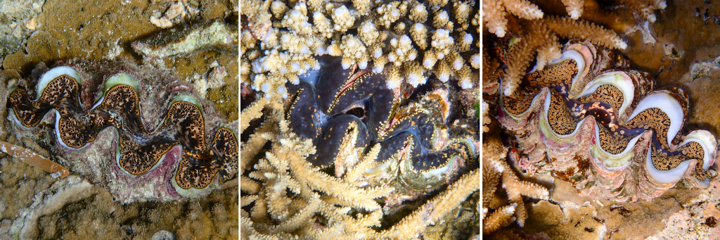
Small Giant Clam, Small Giant Clam, Noah’s Giant Clam
The clam has two openings in its mantle: the incurrent siphon, which it uses to draw water in, and the excurrent siphon, which it uses to expel water. In between, it filters detritus and plankton from the water and transports them to its mouth for digestion.
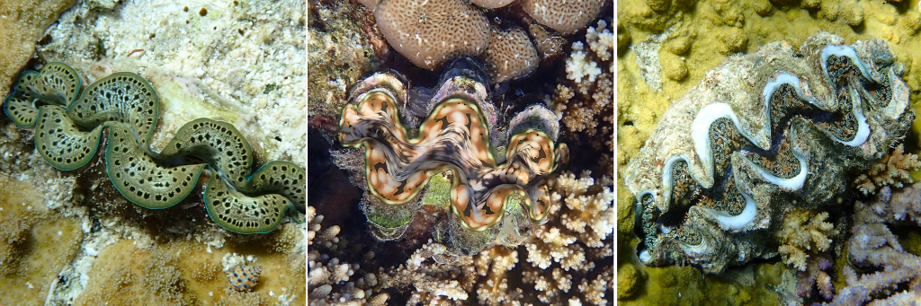
Small Giant Clam, Fluted Giant Clam, Noah’s Giant Clam
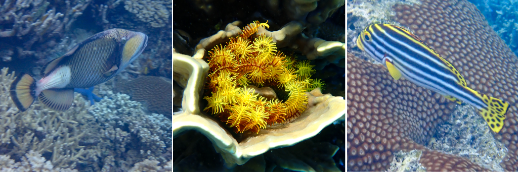
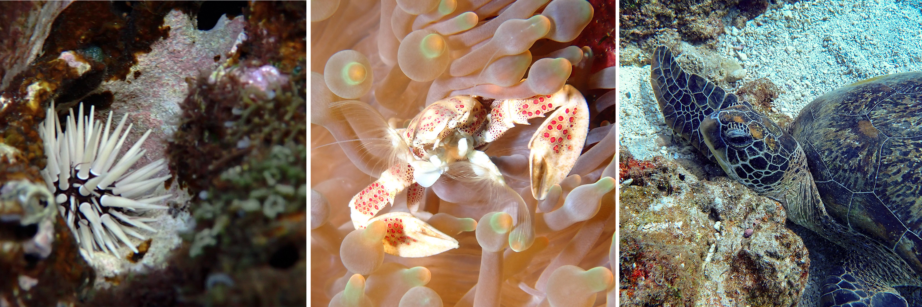
Bull Shark Dive
The first time I snorkeled with a California Leopard Shark I remember how my breath caught just for a moment, before my brain could remind my body to calm down and just enjoy the experience. Leopard Sharks are harmless, but much of the media surrounding sharks has turned all sharks into feared creatures far out of proportion to the actual risk they pose. We are about 50 times more likely to die from being struck from lightning than being attacked by a shark.
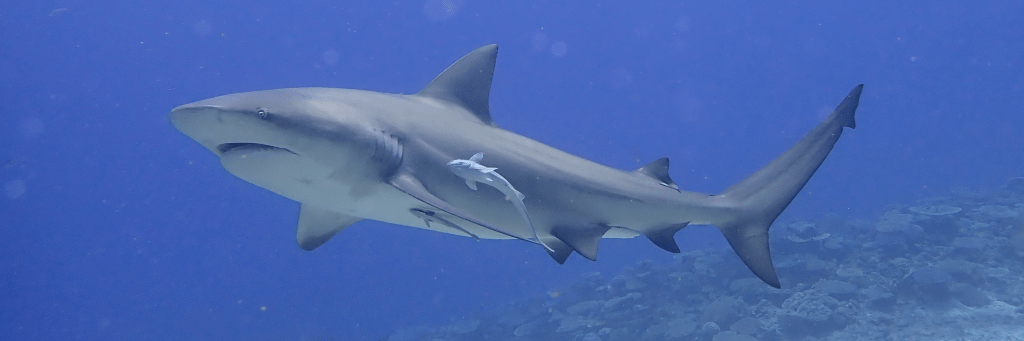
Nonetheless, I’ve had to learn to manage my fear and recognize real risk versus perceived risk. The black and white reef tip sharks in the photos above rarely ever attack humans. There are a handful of records of them biting humans, but generally they are shy and remain apart from divers.
There are however three species that account for the most shark attacks: Great White Sharks, Tiger Sharks and Bull Sharks. I have absolutely no interest in cage diving with Great White Sharks, but one resort in Fiji has been offering daily Bull Shark dives for over two decades, and I signed up.
Bull Shark (with two remoras close by)
Remoras are interesting fish with a suction-disk on top of their heads that allows them to attach to the undersides of larger animal. They eat the leftover morsels that the sharks don’t grab, as well as waste 💩 that comes from their hosts.
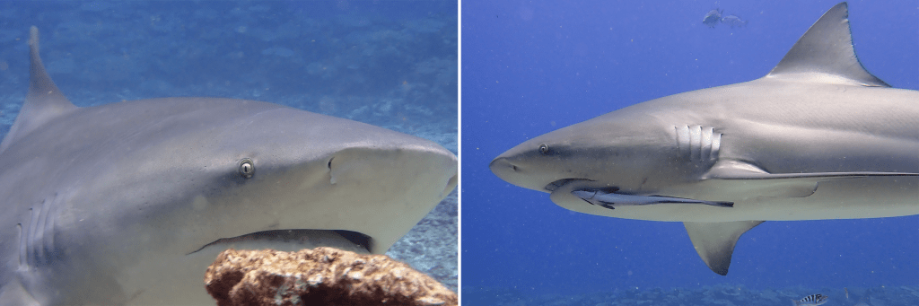
close up of Bull Shark face, Remora attached to bottom of shark’s head
Bull Sharks have the scientific name Carcharhinus leucas. The first part comes from the Greek karcharos which means sharp and rhinos which means nose. Leucas from the Greek word for white which apparently refers to their white underbelly.
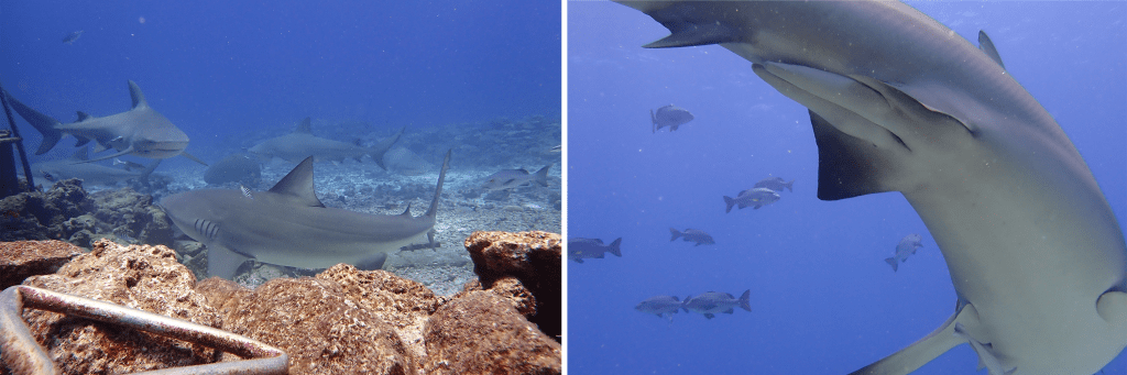
This dive is very different from regular scuba dives. The dive starts with a swim over a shelf and then descends to a viewing platform. All the tourists crouch on their knees behind a rock wall and everyone has a bodyguard standing behind them. Each bodyguard has a metal pole that ends in a triangle shape (see photo below). They use this pole to gently guide the shark away from the tourists when they get too close. Once everyone is ready, other staff members start feeding the sharks fish heads. Tours happen twice a day and the sharks are really good at showing up for meal times.
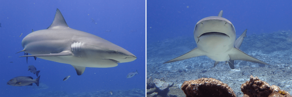
bodyguard pole, male shark’s reproductive organs called claspers
In the picture above, the male shark’s claspers are also visible. For whatever reason, male sharks have two organs that can be used to inseminate a female shark. They only use one at a time during intercourse, apparently whichever one is more convenient based on which side they are on.
The sharks did get very close and often swam right next the divers. I thought the whole experience was magical and surreal. There were several giant sharks swimming around me, but inside I just felt completely calm. I felt safe and protected by my bodyguard and just very lucky to have the experience.
more shark close-ups (notice the hook on the shark’s mouth)
This video doesn’t fully capture the experience, but it at least gives a small taste of what it was like. (I recommend watching it in full screen.) Also, I want to give a big thank you to the scuba staff photographer who taught me how to properly use white balance at depth so my photos are finally coming out much closer to their true colors.