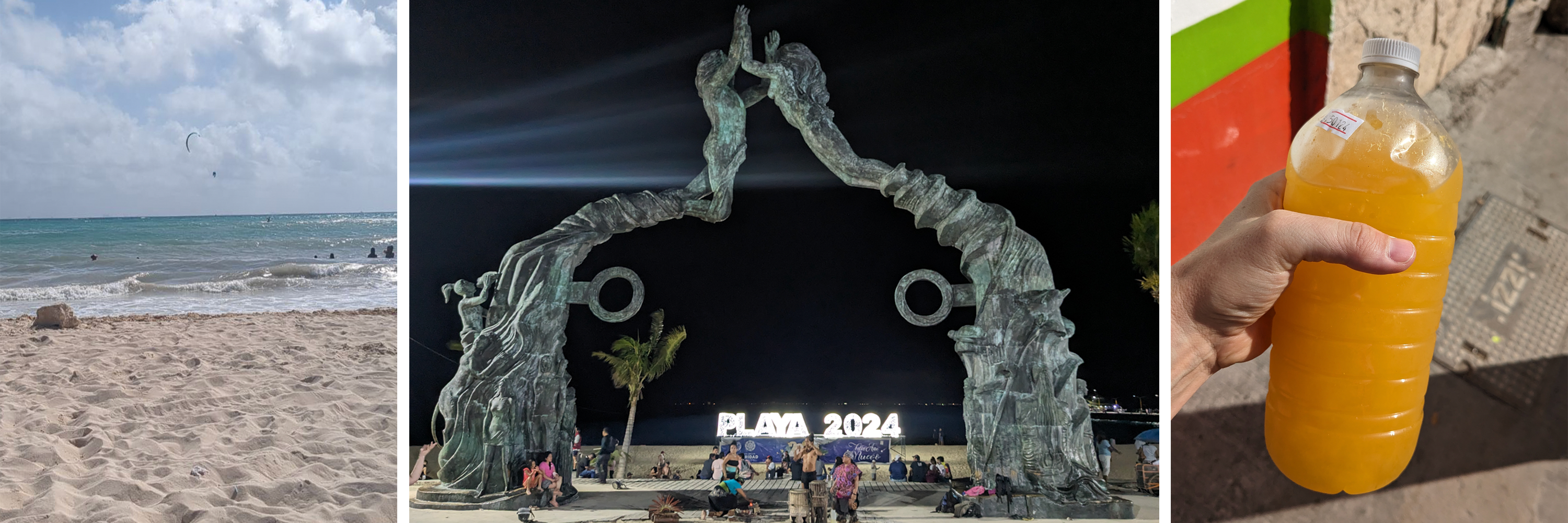
Ancient Mayan City
Despite being one of the largest and most powerful Mayan city states, Calakmul has never gotten the same attention as Chichen Itza to the north and Tikal to the south. It does have UNESCO World Heritage status, but I’d never even heard about it until I started looking through my guidebook. Right now, the public transportation options are limited and there aren’t many group tours, so it’s challenging to get to. I chose to rent a car in Bacalar and drive many hours on pothole-filled roads. However, everything is changing: the Tren Maya is currently being built (all the heavy trucks contribute to the pothole problem) and will probably be done in the next year. This area will soon be inundated with tourists. The tiny 20-car parking lot is being expanded; the roads are being widened and repaired. Tourism and its impact on the area is about to explode.
Because I knew almost nothing about Mayan history and culture, I hired a guide for this tour and we met at 4:30 in the morning so that we could arrive in the park right when it opened. There were only a couple other people wandering around at that time and it is truly surreal to try and imagine the hustle and bustle of a once-thriving capital city when almost no one is around. The view from the top of the king’s pyramid (Structure II) is incredible: a clear view of miles and miles of trees. But 1500 years ago, there would have been settlements and roads in every direction. Even though the large structures of Calakmul have been excavated, the foundations of the old city remain buried beneath the trees.

from the top of Structure II, the home of the former kings of Calakmul and one of the tallest Mayan pyramids
The king’s palace actually has two levels and it is impossible to see the place where I’m sitting from the ground. The king’s quarters on top would’ve been relatively hidden from the common folks down below. He also would’ve had an elongated head because all of the elite Mayans had their heads tightly bound as children. Everyone in the elite class actually looked completely different from the rest of the people. Mayans also engaged in face scarification and wore a lot of heavy jewelry, especially in their ears.

view of the king’s palace from the bottom, a close up of one of the stelas that depicts a ruler standing on top of a slave who is kneeling
Stelae were often constructed to commemorate people and events. Many of the stelae at Calakmul are in bad shape. There are a few different ways to write in Mayan language: one way uses pictures to depict a specific meaning, another uses pictures to match the syllables of the word, and a third combines both of these together. Despite the complexities, experts can generally decipher most Mayan script today.

top part of stela showing the ruler standing above the slave, view of 5 stelae from the top of Structure I (pyramid that was probably used as a temple)
The pictures below show another large pyramid (Structure VI) where astronomical sightings were made. This building and others were built so that the sun would line up in specific places on the solstices and on the equinox. Some of the engravings on the sides of the stelae are still very clear even after all this time. Although the front and back of these stelae were removed by looters, the sides discuss the people involved as well as the dates of events.

view from bottom of the pyramid, view from top of the other two large pyramids, engravings on side of a stela
So far, at least four tombs have been found inside the king’s pyramid and even more tombs were found in other structures. Even houses of common folk have skeletons buried inside of them. The bodies of the elite class were buried with elaborate outfits and offerings to the gods.
Many graves not only have masks made of jade, but also necklaces, ear plugs, and other fancy adornments. There is no jade in Mexico, so all of this jade was most likely imported from what is now Guatemala, which shows the extent of trade in the region. All of these jade funerary masks below were found in Calakmul, but were removed and put into museums in the city of Campeche. (Side note: this is actually one of the reasons it took me so long to write about this, because I had to go to Campeche to see these masks.) The mask in the top right is the most elaborate and probably belonged to Yuknoom Yichʼaak Kʼahkʼ, the ruler of the Mayan snake kingdom starting around 650 CE.
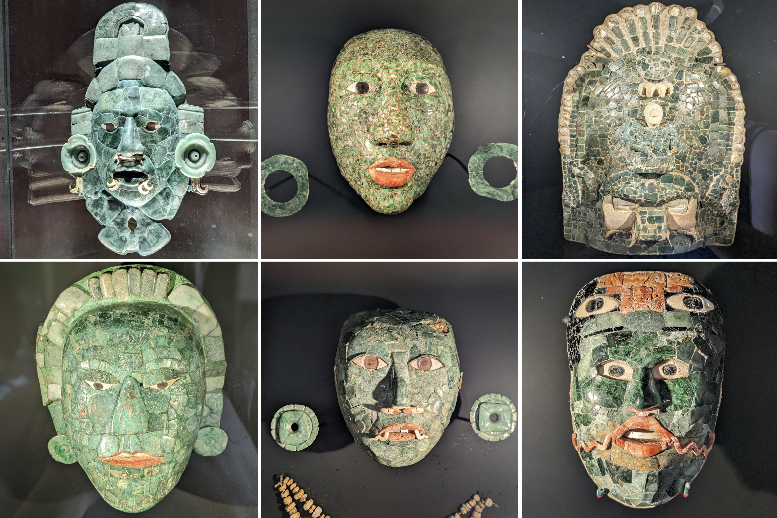
top row (l to r): mask of Yuknoom Yichʼaak Kʼahkʼ, jade mask & ear plugs with cinnabar used on the mouth, another intricate mask depicting a few different animals
bottom row (l to r): a mask representing Yuknoom Ch’een II (the father of Yuknoom Yichʼaak Kʼahkʼ), another jade mask & ear plugs, jade mask probably for a priest with a second set of eyes representing his supernatural vision and the red lines on his cheek showing ritual scars
Calakmul Biosphere Reserve
After our tour of the ancient city, my guide took me on a short walk through the nearby protected natural area. Even wearing insect repellant, a swarm of mosquitos kept threatening to attack my face. There’s so much to see in the rainforest, but my guide started by showing me the chewing gum (chicle) tree. By cutting diagonal lines in the trunk, they were able to get the natural resin to flow and that was harvested and exported to make chewing gum. I also was introduced to the Mayan breadnut (ramón) tree which is used to make bread or a type of porridge. We came across a swamp and I could see a crocodile hanging out on a log. Perhaps the most exciting thing I saw was on our slow drive (avoiding potholes) back to the entrance, when a tayra crossed the road. I didn’t get a photo of it (but Wikipedia has some) and my guide said it was only the third time he’d ever seen one. Folks here call them the viejo de monte (old man of the mountain) because of their white heads.
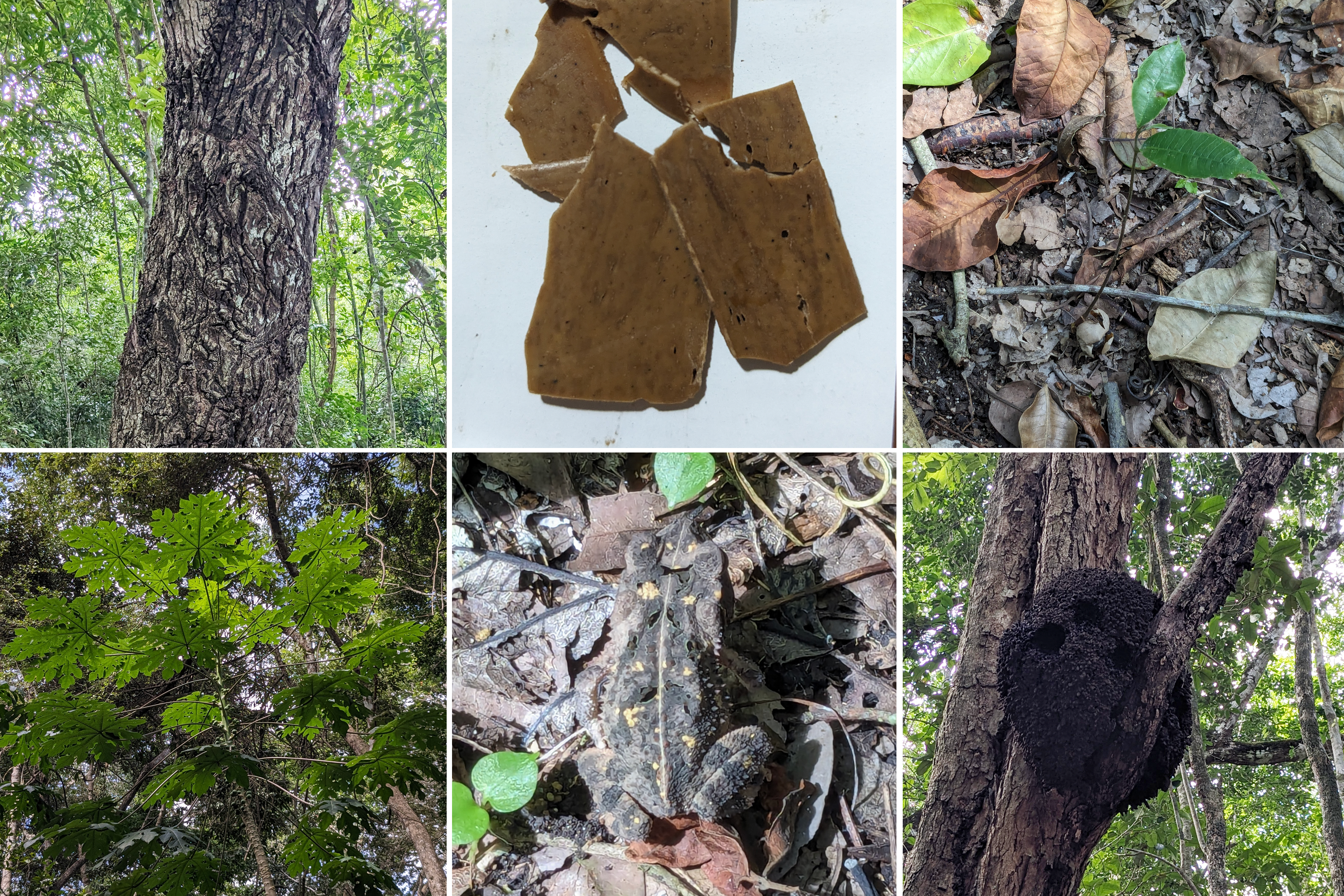
top (l to r): chicle tree with scars, natural chewing gum, Maya breadfruit tree starting to grow from seed
bottom (l to r): papaya tree, Central American Gulf Coast toad, termite nest with holes most likely made by parrots that are living inside of it